I study how water, the material it moves, and nutrients it contains move across the landscape and are transported downstream. This includes how management decisions affect the quantity and timing of when water moves through the soil and river networks. My current research seeks to understand water management decision-making through co-production of research and to incorporate that knowledge into various modeling frameworks. This is fundamental to understanding how the location and history of water on the landscape effects various environmental processes, and the patterns they create.
Assessing the impact of land use and land cover changes on river diversions in semi-arid river basins
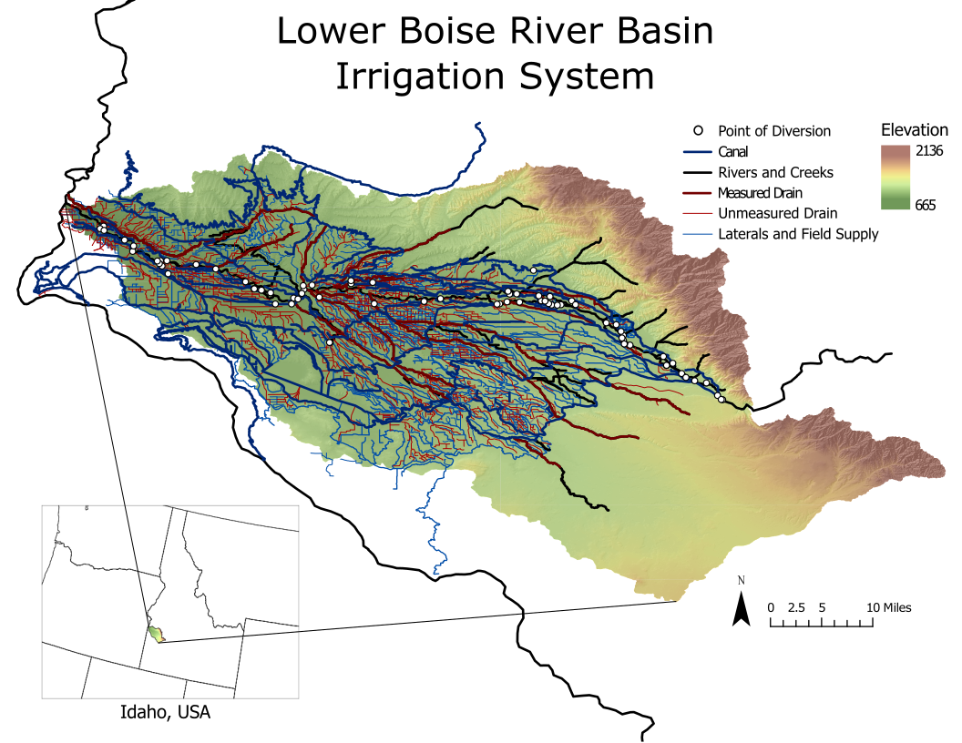
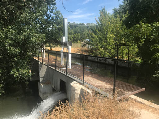
Treasure Valley Irrigation System. Map by MS Student Bridget Bittmann
|
This research has developed methods for quantifying both historical and predicted future changes in river diversions, from the Boise River. As the region continues to urbanize, land use and land cover change is anticipated to have impacts on the timing and magnitude of water used in the Treasure Valley. We have developed statistical models using spatial LULCC and climatic data to determine how LULCC-driven changes in water use have affected river diversions across irrigation districts in the Treasure Valley. The statistical models will be discussed and developed in coordination with the US Bureau Reclamation, the Idaho Department of Water Resources, and Water District 63 to understand local complexities of the diversion networks and operations and model uncertainties. This model will be useful for simulating water demands and diversions here and in other river basins. Better statistical data and planning models could help inform decision makers and potentially lead to improved system management.
|
Evaluation of the spatial variability of E. coli in irrigation canals for the FDA Produce Safety Rule
|
This project will enhance the competitiveness of Idaho specialty crops by assessing the spatiotemporal variability of E. coli in irrigation canals in southern Idaho. Project deliverables include a sampling protocol that will allow irrigators to comply with the new Food & Drug Administration (FDA) Food Safety Modernization Act Produce Safety Rule. Water sampling has occurred in two participating irrigation districts over two years. In addition to quantifying E. coli we have measured dissolved oxygen, temperature and total suspended solids to determine if other, more easily made measurements, can be used to flag times and locations that are potentially problematic. We also instrumented one canal to calculate stream metabolism over one irrigation season, one of the only canals where stream metabolism has been measured.
|
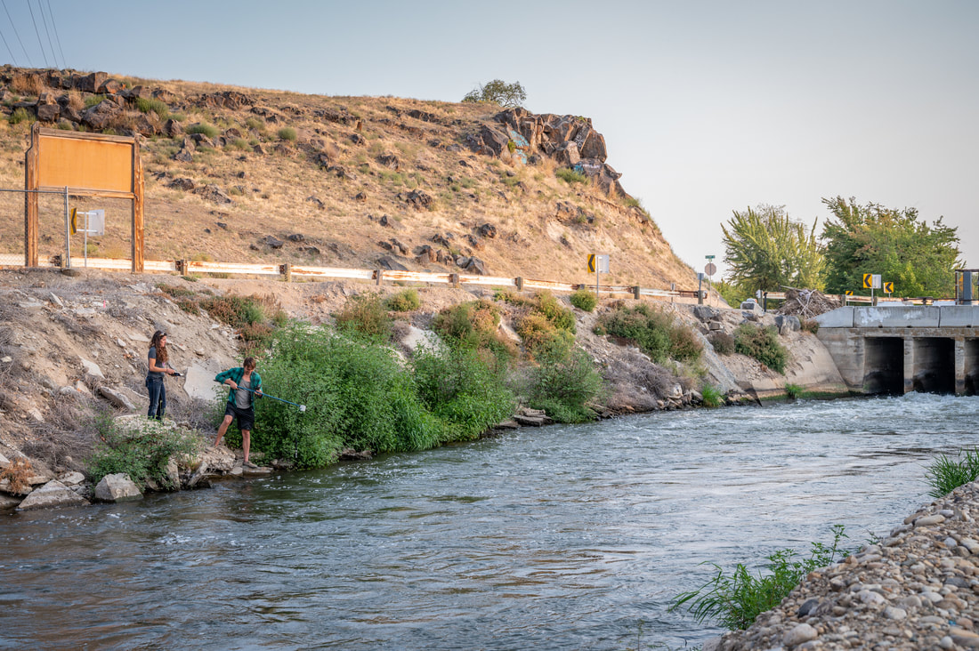
Sampling the Farmer's Co-Op canal with MS Student Reed Chasmar, photo: Boise State
|
Development of a streamflow data catalog and evaluation of climate vulnerability for sensitive fish species across the Pacific Northwest
|
As the amount of environmental data continues to grow, efforts to coalesce existing data and integrate associated modeling products are increasingly necessary for effective application of modeling tools to land, water, and species management. Identifying existing data increases transferability, decreases redundancies, and helps establish protocols for future data collection efforts. Further, without focused efforts to integrate modeling products, we have limited ability to provide managers with tools to assess challenging issues of water availability and species conservation. This project informs climate adaptation efforts in the Pacific Northwest (PNW) by 1) developing a catalog of existing, non-USGS measurements of streamflow and 2) assessing the vulnerability of rare fish species based on their ability to cope with changes in streamflow and water temperature expected under climate change.
|
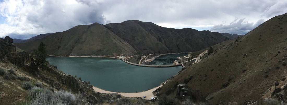
Predictive Flow Model of Silver Creek, Camas Creek, and the Big Wood River above Magic Reservoir for the Wood River Water Collaborative
Water resources management can benefit from tools that integrate data sources to provide timely information about water availability, particularly when designed based on stakeholder needs. Developed properly, with appropriate uncertainty characterization, these tools can improve management of surface and groundwater resources for both agricultural and conservation goals. To meet these needs for the Wood River Water Collaborative (WRWC), this project will develop predictive models for the Wood River and Camas Creek above Magic Reservoir and on Silver Creek.
Co-Production of Research - improving water data infrastructure for water management in southwest Idaho
Water resources management involves integrating individual and institutional decision-making, but these processes are often over-simplified or not included in associated hydrologic models. Engaging with stakeholders to understand what information they use to make decisions is a critical step in assessing how management strategies could adapt to changing environmental conditions. This project will contribute to efforts to quantify the recent and potential changes to water demand and consumptive use due to population growth and associated land use change in the Treasure Valley, Idaho. I am working with irrigation districts to increase measurements of canal stage and seepage rates, and evaluate how the management of these systems have and will change in a rapidly urbanizing environment.
Agent Based Modeling of Water Resources and Land Use Change
Gaining a holistic understanding of water resources in urban settings requires knowledge about the physical system (e.g. climate, vegetation) and the social system that stores and moves water across the landscape (e.g. reservoirs, irrigation canals). The goal of this project is to model the hydrology of the Boise River Basin by coupling a hydrologic model and a social model representing how we move water through the basin.
While building our coupled model, we will create framework for modeling water resources with agent based models (ABM). ABMs are models where individuals (agents) are unique entities that interact with each other and their environment. This type of model allows for agents to adapt to new information based on their objectives and decision – making strategies. Vicken Hillis’ work on behavior and decision making in environmental settings highlights the complexity that this creates in a given system. Our goal for creating a water resources ABM framework is to make these models more transferrable across systems, which could increase synthesis of findings across basins. A first step will be to characterize the main ‘agents’ that use and manage water resources. This is being done in conjunction with the ID EPSCoR Treasure Valley Water Atlas project which is characterizing where Boise River Basin water comes from and how it moves through the basin (Shawn Benner, Jill Moroney, Jen Schneider).
Coupling our ABM with a regional hydrologic model (WRF-hydro) will allow us to examine emergent properties of the system as the agents respond to various climatic scenarios (Lejo Flores), and landuse change (Jodi Brandt). This dynamic model could be used to assess questions like: Will current water management practices work well in an extended drought? How will the conversion of agricultural land to urban development impact water demand and streamflow? This could improve synthesis of findings across basins, and increase use of coupled social-ecological system models for examining complex water resources issues.
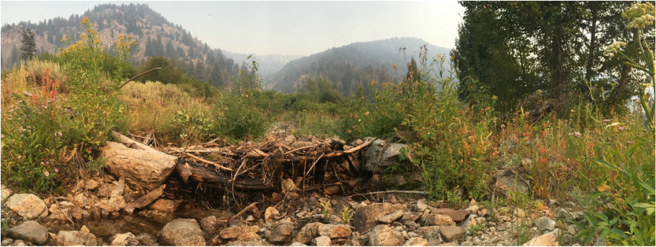
Streamflow Intermittency Project
NSF GRIP - USGS ID Water Science Center
With lower than average snowpack, many western streams reached peak flows earlier in the 2015 season, and dropped to historically low flows. Considering the large socio-economic and ecological implications of drought, it is imperative to gain better understanding of stream flow conditions in a changing climate. Headwater streams account for 90% of the stream network, they can contribute large amount of water to the network and are integral to supporting healthy ecosystems. The goal of this project is to create the Headwaters Intermittency Prediction (HIP) tool, it will benefit resource managers in the western US by improving their ability to anticipate when and where streamflow is likely to reach critically low levels, allowing them to target drought relief efforts. During this internship I compiled and assimilated various data sets and remote sensing products to calibrate the models underlying the HIP tool. I also created an ArcGIS Web App for collaborators to add additional observations of stream permanence in Oregon, Washington, and Idaho.
Greenhouse Gas Fluxes
NSF GRFP - Ecohydrologic influences on soil trace gas fluxes across complex terrain
There are large uncertainties in land-atmosphere- climate interactions, feedbacks, and controls over CO2 fluxes, and even more so for N2O and CH4, particularly in mountainous regions. This research project is using a landscape framework to examine spatiotemporal controls over soil trace gas flux in watersheds of differing climatic regimes, topographic structure, and vegetation patterns. Improved integration and transferability of point scale measurements to landscape scale estimates of gas flux are the main goals of the project. In the future, these estimates could be incorporated into regional models, allowing for further assessment of how global climate and land-use change affect terrestrial and aquatic nutrient cycling.
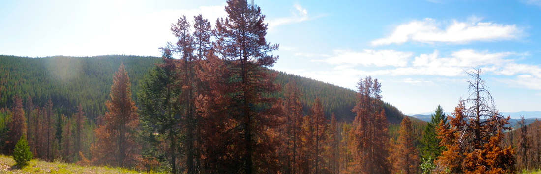
Mountain Pine Beetle
Montana State - Undergraduate Research Project
The Mountain Pine Beetle (MPB) outbreak in the Rocky Mountains was the greatest biological cause of mature pine mortality in western North America from in the early 2000s. We used high resolution (2.4m) QuickBird imagery to to examine the pattern of the MPB outbreak on the landscape. Using topographic metrics of water availability, we found that infested and dying trees were more prevalent in dry landscape positions. This supports research on MPB outbreak dynamics, while showing one way high resolution remote sensing products can be used to observe and analyze ecohydrologic patterns at the landscape scale.
